SIDE PROJECT 08 / 13
GeoGetter
AI-powered image geolocation using Claude's visual intelligence and OSINT techniques.
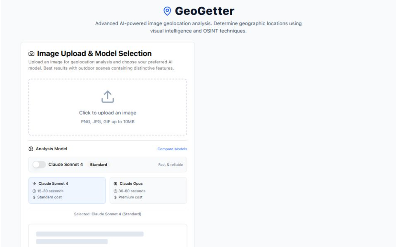
GeoGetter analyzes visual features in an uploaded image and identifies likely locations based on architecture, landscapes, signage, and other distinctive elements — choosing between Claude Sonnet 4 for fast results or Claude Opus for premium, more detailed analysis.
Global
ANALYSIS
WORLDWIDE COVERAGE
2
AI MODELS
SPECIALIZED ANALYSIS
10MB
UPLOAD SIZE
IMAGE SUPPORT
15–60s
PROCESSING
FAST ANALYSIS
ABOUT
It excels with outdoor scenes containing distinctive features, pairing custom geolocation prompting with a caching layer for similar images to keep repeat analysis fast.
- Dual AI model support: Claude Sonnet 4 (fast) or Claude Opus (premium detail).
- Confidence-scored location assessments with visual-marker references.
- Community feedback loop for improving result accuracy over time.
- Ethical-use guardrails and privacy-focused implementation for OSINT workflows.
HOW IT WORKS
01
Image analysis
Upload and analyze images for location identification.
- PNG, JPG, GIF up to 10MB
- Visual feature extraction
- Fast processing pipeline
02
AI model selection
Choose the right model for the job.
- Claude Sonnet 4 (15–30s)
- Claude Opus (30–60s, premium)
- Performance comparison tools
03
Analysis results
Detailed geolocation output.
- Location assessments with confidence indicators
- References to visual markers used
- Result feedback for model improvement
UNDER THE HOOD
Next.jsTypeScriptClaude AINext.js + TypeScriptTailwind CSSClaude AI APIResponse caching